Experience advanced multi-constellation technology and patented fence antennas with our GNSS receivers. These devices have long battery lives and work in various weather conditions to ensure consistent performance.


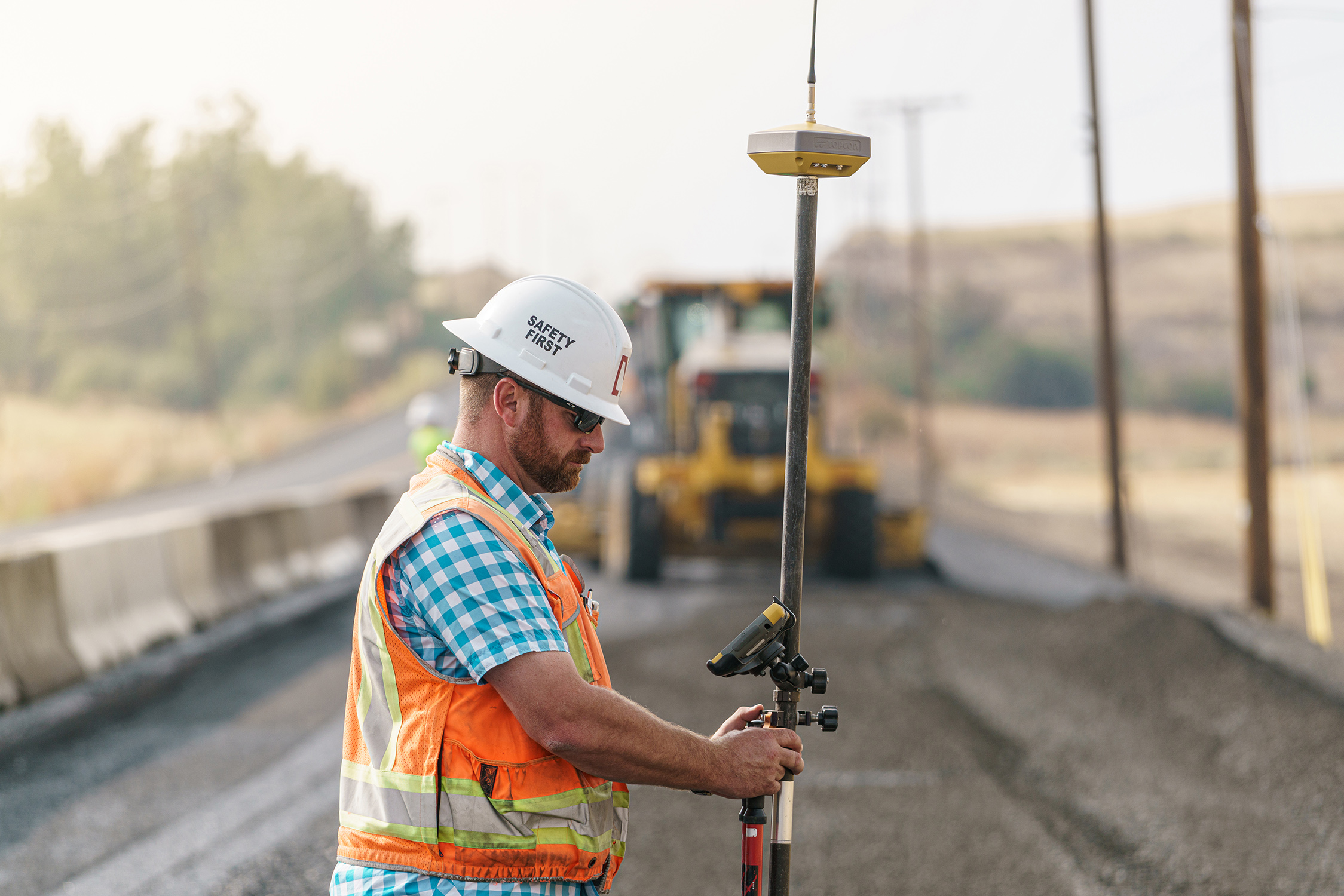
In projects where mobility plays a pivotal role, a global navigation satellite system (GNSS) solution optimizes the process through seamless system navigation and positioning via sensors. Dobbs Positioning Solutions features a wide range of GNSS products and Network Solutions that are designed for ultimate speed and precision without breaking the bank.
Contact Us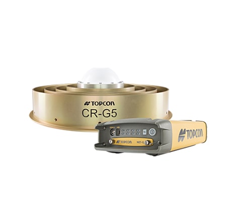
Changes in demand contribute to the variety of solutions on the market, and GNSS network solutions for construction are a solid resource for contractors and site surveyors. These tools allow you to complete projects on schedule to improve efficiency and revenue.
In addition, this high-quality tracking equipment caters to all forms of transportation and key areas such as:
Time is of the essence in the construction industry. As such, we offer a series of Topcon GNSS solutions to improve productivity in your operations. Each piece of equipment focuses on delivering quality results through optimized processes and constant reliability.
Our collection of Topcon GNSS solutions includes:
Experience advanced multi-constellation technology and patented fence antennas with our GNSS receivers. These devices have long battery lives and work in various weather conditions to ensure consistent performance.
Enhance your projects with a solid and portable UHF radio. The Topcon GNSS radio offers steady signal strength even in the most challenging situations. It comes with customizable output power, an extensive operating range and a multifunction user interface for smoother operations. The radio’s portability enables you to carry it anywhere for all your geopositioning needs.
Enjoy GNSS antennas that are equipped with top-tier features such as an integrated ground plane and ultra-rugged design for clean and seamless signal isolation. Some have vertical convex dipoles to establish stable full-wave signal tracking. These satellite-based antennas for construction projects are also used for various applications like geopositioning, OEM manufacturing, land surveying, and even forestry.
Benefit from state-of-the-art technology that helps contractors and surveyors optimize challenging tasks. From station receivers to full-wave antennas to ASIC chips, these reliable network solutions fulfill specific needs in the most accurate and efficient manner.

Dobbs Positioning Solutions makes it easier for you to find the right equipment for your needs. We offer a comprehensive collection of GNSS solutions that are designed to:
Purchase GNSS network products from our website today and enjoy free system inspections. Dobbs Positioning Solutions ensures you get the appropriate solution for your infrastructure. More than that, our team of experts is equipped with in-depth knowledge and skills to help you with the selection process.
Learn More